Proven at Scale
From territory-scale energy grids to heritage site preservation — our digital twins solve real infrastructure challenges.
Generative tower designs placed on a geo-accurate terrain replica — drag to compare design variants
Original tower designs by Choi+Shine Architects
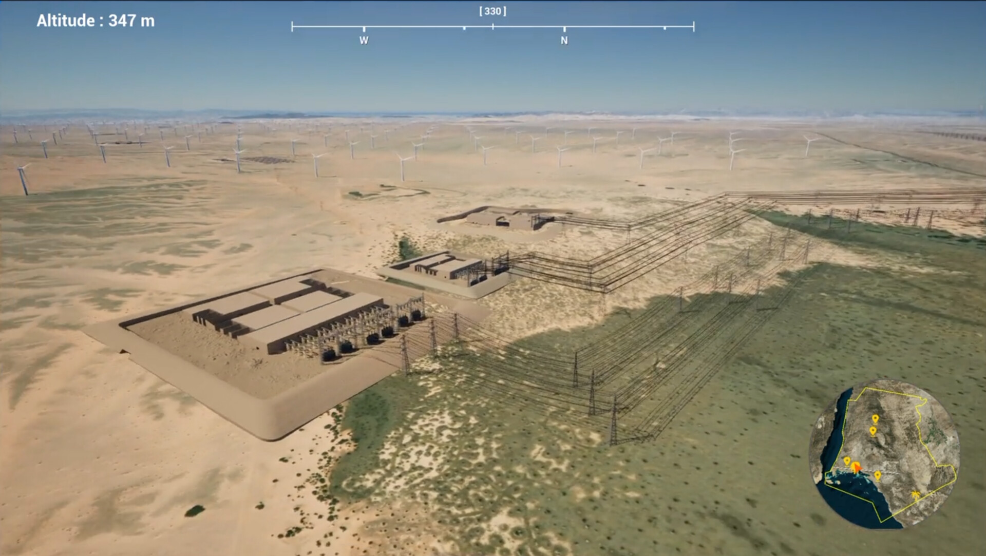
25,000+ km² · Greenfield Development
Territory-Scale Power Grid
Complete electrical grid digital twin — transmission lines, solar farms, wind turbines, substations — all generated from GIS data and projected onto real terrain. Side-by-side scenario comparison for overhead vs. underground cabling with a year-by-year construction timeline.

Landmark Complex · Interior & Exterior
Heritage Site Immersive Experience
Full-scale LiDAR capture and photorealistic reconstruction of a world-renowned heritage site. Delivered as an interactive Unreal Engine 5 experience on desktop, VR, and touch tables — with 50,000+ agent crowd simulation and emergency evacuation modeling.
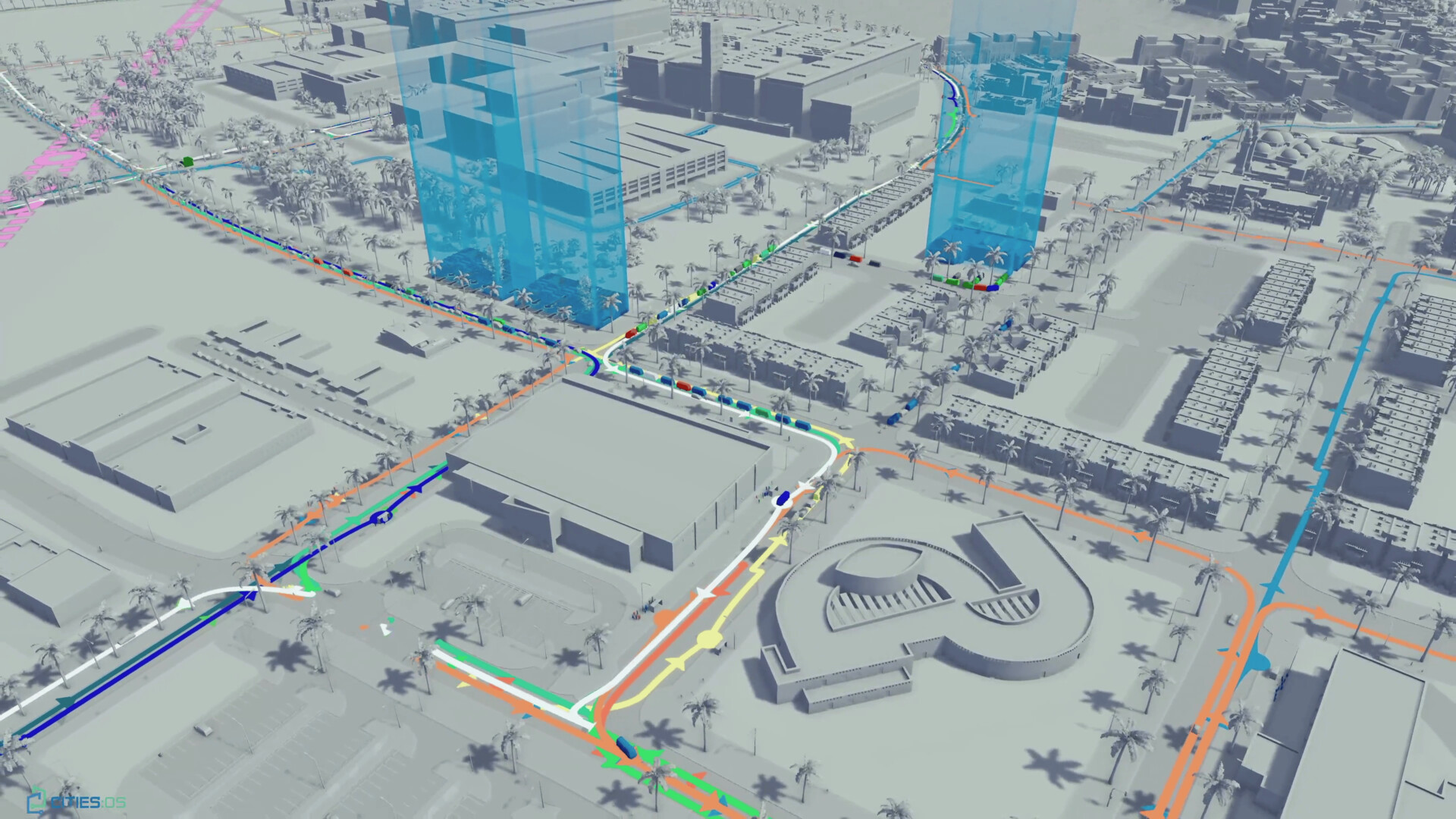
University Campus · 10,000 Inhabitants
Campus Digital Twin & Mobility
Full campus replica with agent-based population model, validated transport simulation, underground infrastructure mapping, and scenario comparison for transit alternatives — tram vs. bus line impact analysis with real consumption data.
Photorealistic Capture · In-Browser Tours
Step Inside Any Space
We turn 3D Gaussian Splat captures into interactive web tours — complete with embedded video screens that bring lab equipment to life, and dynamic A* pathfinding that walks visitors smoothly between points of interest.
- Photoreal capture. Real lighting, real materials, real geometry — no manual modeling, no texture cleanup.
- In-scene video screens. Equipment that explains itself — embed product demos, training clips, or live feeds directly inside the tour.
- Dynamic A* pathfinding. Click any point of interest and the camera walks there — no jump-cuts, no teleporting.
- Runs anywhere. Pure WebGL — desktop, tablet, or phone. No app install, no plugin, no headset required.
Crowd Safety · Capacity Planning · Evacuation
See the Crowd Before It Arrives
Where will people pile up? Where do exits clog? Does your evacuation plan actually work?
Open a link in your browser and watch thousands of virtual people move through a 3D scan of your real space — your stadium, your station, your mosque, your mall. See bottlenecks form before anyone gets hurt. Test what happens if you close a corridor, add a sign, or move an exit.
- Spot trouble before it happens. See where queues spill back and where corridors choke — in your real building, with the real crowd you expect.
- Test your evacuation plan. Run the worst-case drill on a screen, not on the day it matters.
- Compare layouts side by side. Two floor plans, two crowd flows — pick the one that actually breathes.
- Just a link. No app to install, no GPU farm to rent, no engineer needed. Your safety lead, your architect, and your operations crew open the same URL on a phone.
Virtual Commissioning · Operator Training · PLC Validation
Drive the Machine Before It Arrives
Your new CNC arrives in eight weeks. Your operators need training in two. Your PLC team needs to debug the program before the install window closes.
Drop the machine into a 3D scan of your real factory — the actual aisles, the actual columns, the actual fork-lift paths. Drive it. Crash it. Re-program it. Train your operators on it. All before the truck pulls up.
- Pre-commission your PLCs. Debug the program against a moving virtual machine, not a powered-up real one.
- Train operators before delivery. They walk in on day one already familiar with the controls.
- Catch install collisions early. The machine sits where it will actually sit, not on a CAD island.
- Just a link. Your machine builder, your PLC team, your operator, your customer all open the same URL.
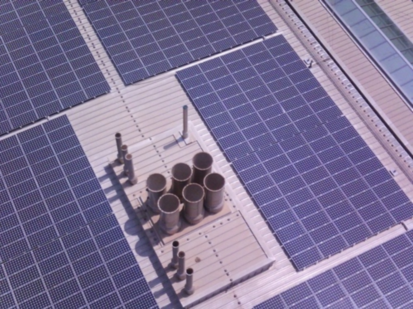
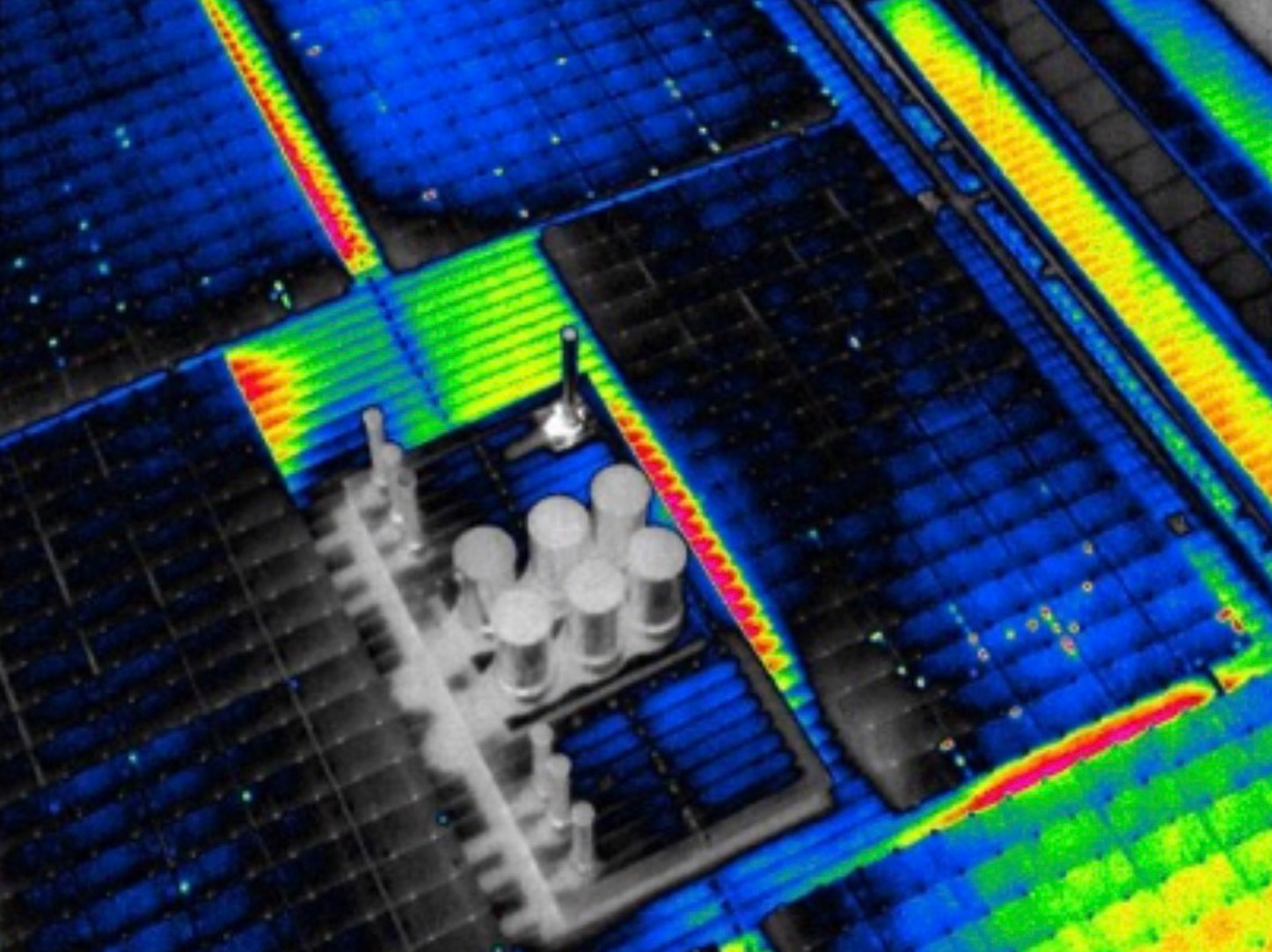
100,000+ Modules · 4M Images Analyzed
Solar Farm AI Monitoring
Deep learning fault detection for large-scale PV plants using drone-based aerial imaging. RGB and infrared thermal captures are analyzed by our AI pipeline — ResNet-50 and Mask R-CNN models achieve 99% anomaly detection accuracy, targeting a 100x cost reduction in operations and maintenance through Hardware-in-the-Loop physics integration.